基于多源遥感数据的疏勒河上游山区流域VIC-CAS模型积雪模拟效果评估
Evaluation on snow coverage and snow depth simulated by VIC-CAS model based on multi-source remote sensing data in mountainous upper reach of the Shule River basin
基于多源遥感数据的疏勒河上游山区流域VIC-CAS模型积雪模拟效果评估 |
| 郭佳锴, 李哲, 李飞, 张世强 |
|
Evaluation on snow coverage and snow depth simulated by VIC-CAS model based on multi-source remote sensing data in mountainous upper reach of the Shule River basin |
| Jiakai GUO, Zhe LI, Fei LI, Shiqiang ZHANG |
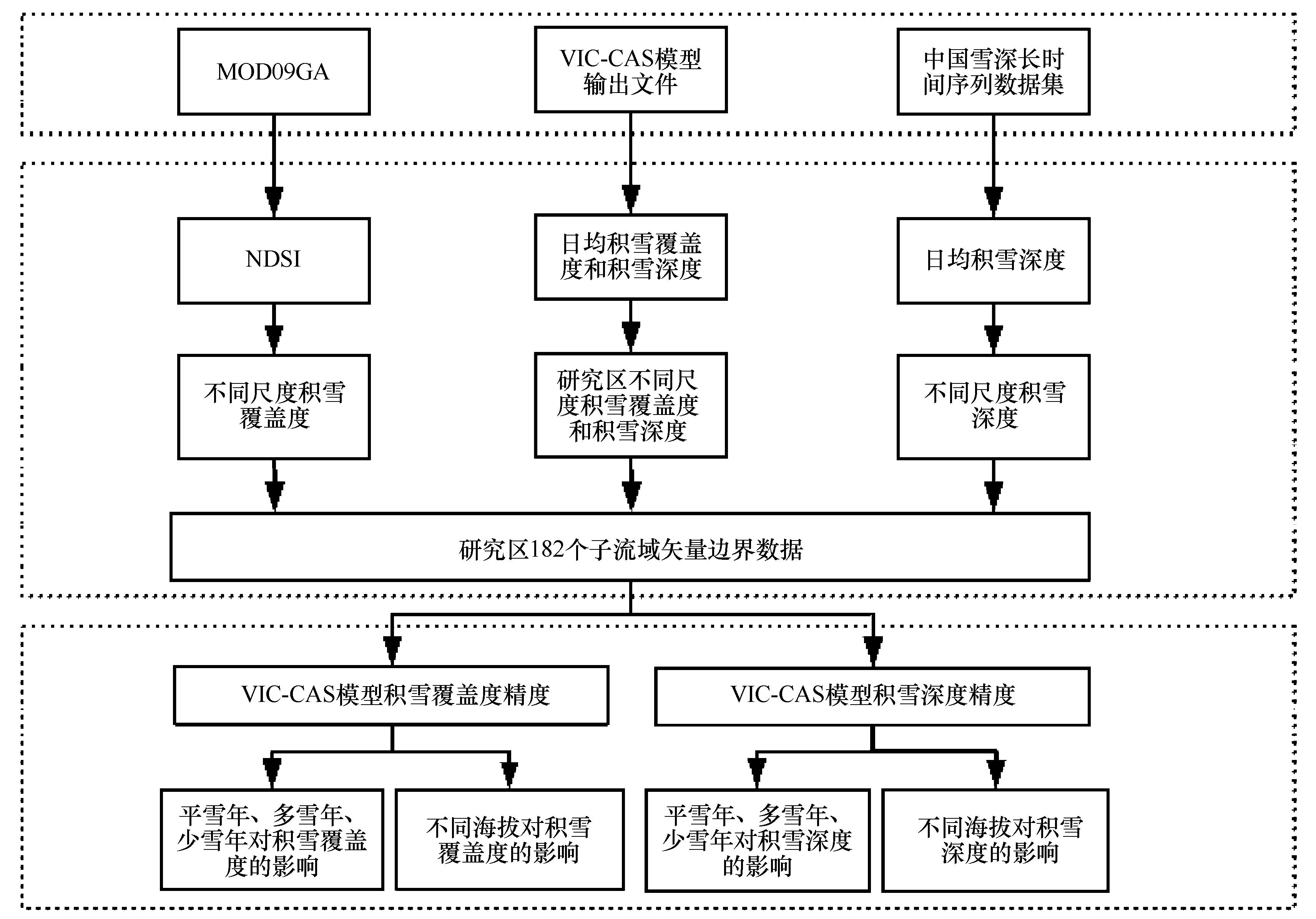
| 图2 疏勒河上游山区VIC-CAS模型模拟和遥感观测的积雪覆盖度和雪深评估流程 |
| Fig.2 Flow chart of the evaluation on snow coverage and snow depth simulated by VIC-CAS model and observed by remote sensing in mountainous upper reach of the Shule River basin |
|
|