基于多源遥感数据的疏勒河上游山区流域VIC-CAS模型积雪模拟效果评估
Evaluation on snow coverage and snow depth simulated by VIC-CAS model based on multi-source remote sensing data in mountainous upper reach of the Shule River basin
基于多源遥感数据的疏勒河上游山区流域VIC-CAS模型积雪模拟效果评估 |
| 郭佳锴, 李哲, 李飞, 张世强 |
|
Evaluation on snow coverage and snow depth simulated by VIC-CAS model based on multi-source remote sensing data in mountainous upper reach of the Shule River basin |
| Jiakai GUO, Zhe LI, Fei LI, Shiqiang ZHANG |
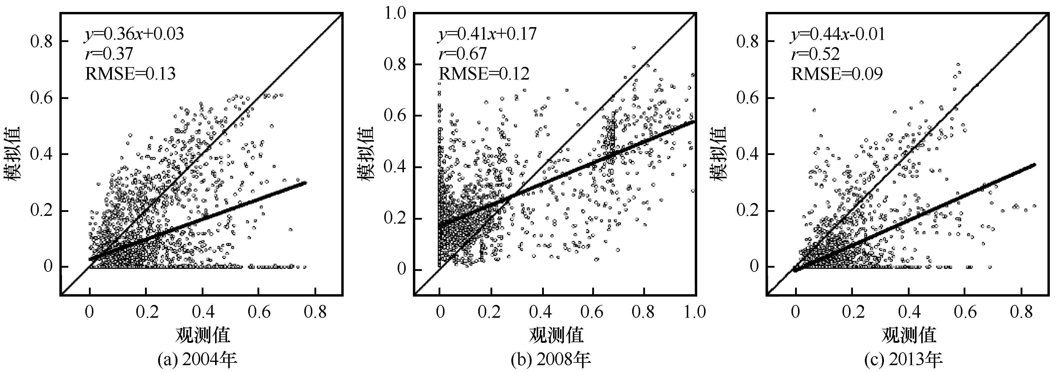
| 图3 VIC-CAS模型模拟和MODIS观测的月平均积雪覆盖度在疏勒河上游山区流域不同降雪年份的对比 |
| Fig.3 Comparisons in monthly averaged snow coverage between simulated by VIC-CAS model and observed by MODIS in mountainous upper reach of the Shule River basin in normal snow year (a), more snow year (b) and less snow year (c) |
|
|