黄河中游响应气候变化和地表相对抬升发育阶地研究
|
|
潘保田,胡振波
|
The study on the terrace development by the middle reaches of Yellow River as a response to the climate change and relative surface uplift
|
|
Baotian PAN,Zhenbo HU
|
|
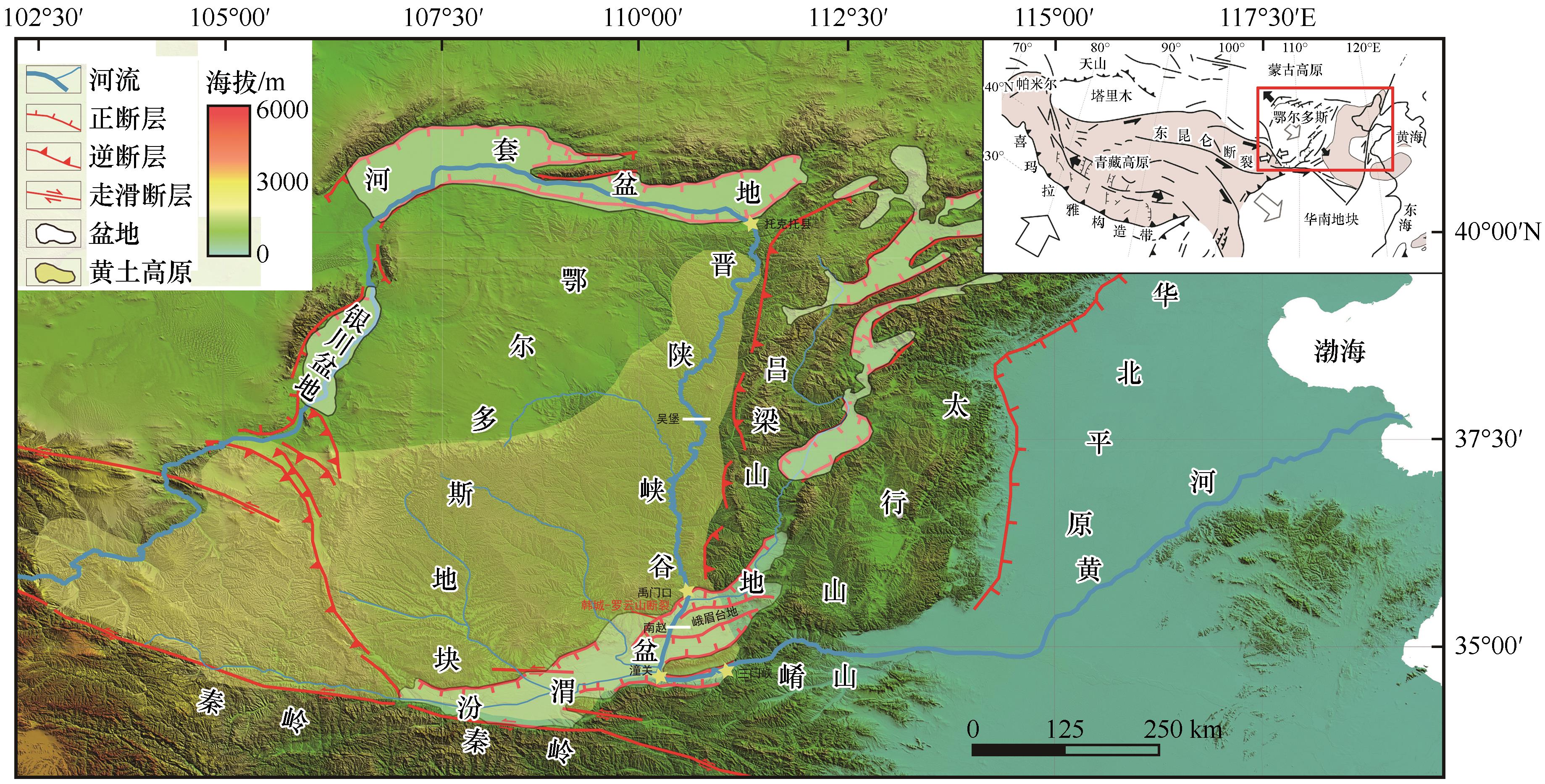
图1 鄂尔多斯地块及周缘盆地区域概况图
注:黄河中游深切鄂尔多斯地块,在托克托与禹门口之间形成了晋陕峡谷,然后它进一步向南切开峨眉台地后在潼关附近转向东流,最后贯通三门峡进入华北平原。在晋陕峡谷中部吴堡,黄河发育了7级阶梯状阶地序列,而在峨眉台地南赵村附近形成了6级堆积阶地序列。二者的横断面图参见图3(a)和3(b)。右上角插入图指示鄂尔多斯地块及周缘盆地相对青藏高原位置以及宏观构造格局
|
Fig.1 Regional setting across the Ordos Block and surrounding basins
Note:The middle reaches of Yellow River excavates the Ordos Block,creating the Jinshaan Gorge between Tuoketuo and Yumenkou,and then it further flows toward south to cut through the uplifted Emei Platform relative to the Fenwei Basin. Finally,the middle reaches of Yellow River turns eastward at Tongguan to go across the Sanmen Gorge and debouch into North China Plain. Seven terrace staircases have been created by the middle reaches of Yellow River at Wubao located in the middle part of the Jinshaan Gorge,while six aggradational terraces occurred at Nanzhao by its downcutting into the Emei Platform. Their cross sections are coincident with the Fig.3(a) and Fig.3(b). The inset map displays the location and tectonic framework of the Ordos Block and surrounding basins relative to the Tibetan Plateau
|
|
|
|
|