黄河中游响应气候变化和地表相对抬升发育阶地研究
The study on the terrace development by the middle reaches of Yellow River as a response to the climate change and relative surface uplift
黄河中游响应气候变化和地表相对抬升发育阶地研究 |
| 潘保田,胡振波 |
|
The study on the terrace development by the middle reaches of Yellow River as a response to the climate change and relative surface uplift |
| Baotian PAN,Zhenbo HU |
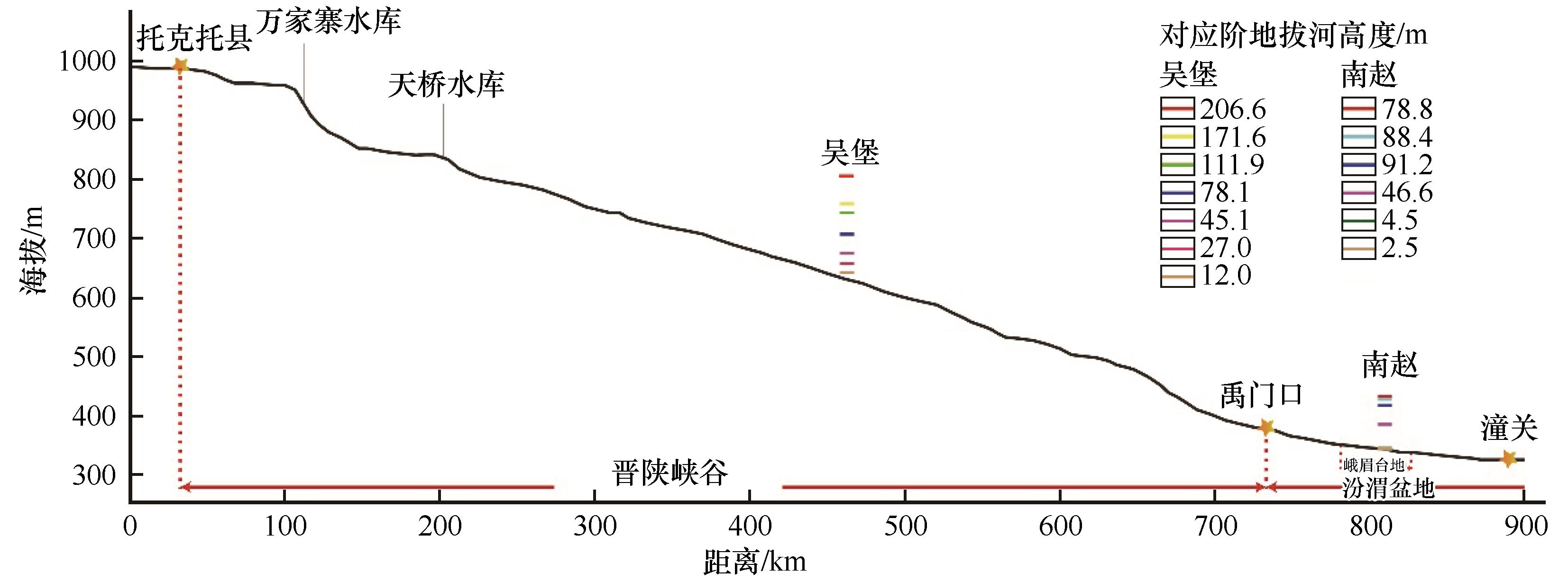
| 图2 黄河中游托克托至潼关间的河道纵剖面图 |
| Fig.2 The longitudinal channel profile of the middle reaches of Yellow River between Tuoketuo and Tongguan |
|
|