黄河中游响应气候变化和地表相对抬升发育阶地研究
|
|
潘保田,胡振波
|
The study on the terrace development by the middle reaches of Yellow River as a response to the climate change and relative surface uplift
|
|
Baotian PAN,Zhenbo HU
|
|
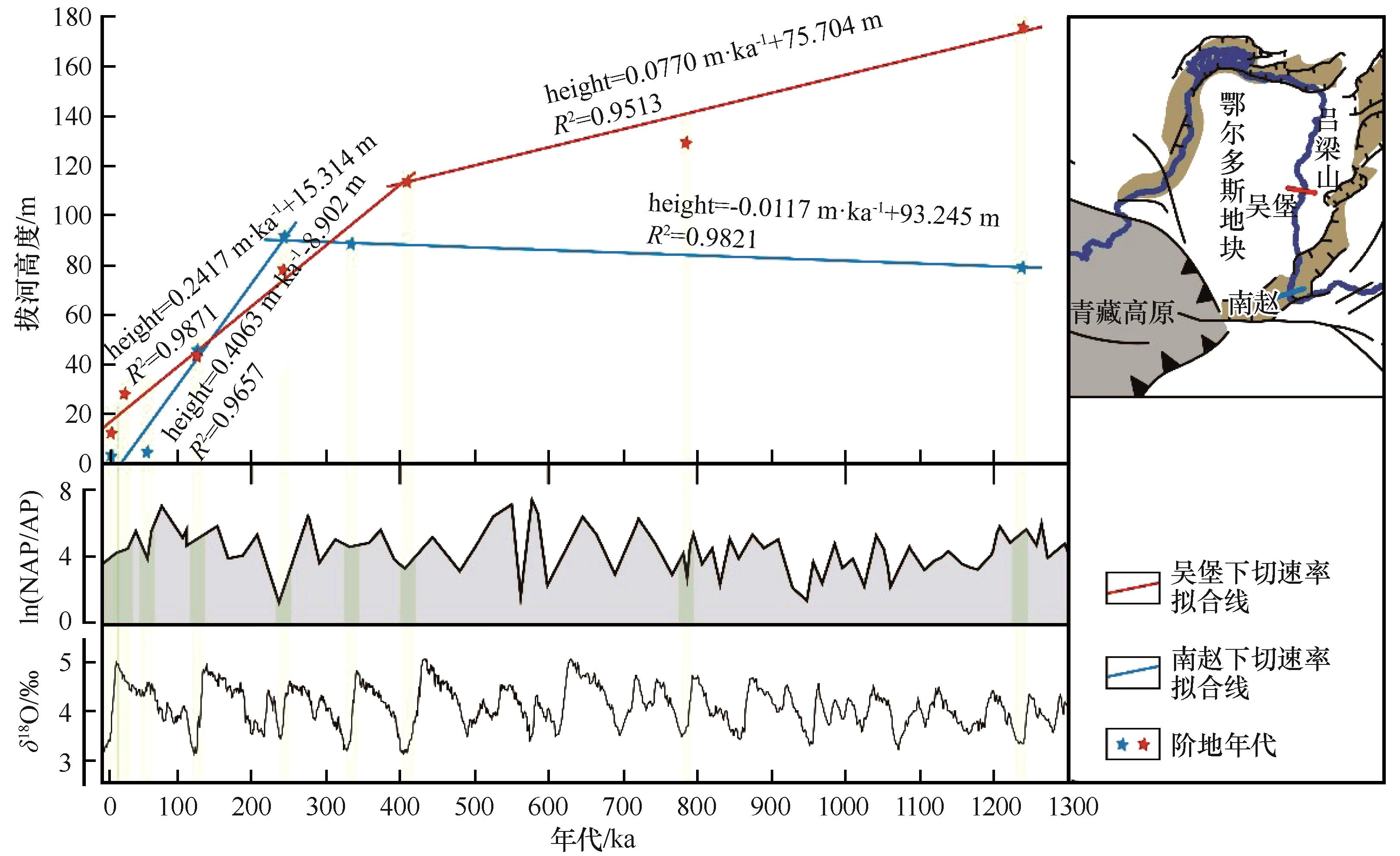
图4 黄河中游下切速率与黄土高原气候记录对比图
注:基于南赵和吴堡阶地拔河高度与年代,分别计算获得1.2 Ma以来黄河下切鄂尔多斯地块和峨眉台地的速率。进一步线性回归分析将它们划分成两个时段。黄土高原孢粉ln(NAP/AP)记录来自文献[43],而深海氧同位素δ18O曲线来源于文献[44]。所有黄河阶地形成于气候由冰期向间冰期的过渡阶段
|
Fig.4 Correlation between the incision rate of the Yellow River and the climate record over the Chinese Loess Plateau
Note:Based on the heights of the fluvial terraces occurring at Wubao and Nanzhao versus their ages,the average incision rates of the Yellow River downcutting the Ordos Block and Emei Platform since 1.2 Ma have been calculated. Further linear regression analysis divided them into two periods respectively. The pollen ln(NAP/AP) record of the Chinese Loess Plateau mentioned here is from the reference[43], while the benthic δ18O curve is obtained from the reference[44]. All the Yellow River terraces have been formed at the transitions from glacial to interglacial climate
|
|
|
|
|