氧同位素示踪夏季北冰洋(62.3°~74.7° N)大气硝酸盐形成途径的研究
Using oxygen isotopes to trace the formation pathways of atmospheric nitrate over summer Arctic Ocean (62.3°~74.7° N)
氧同位素示踪夏季北冰洋(62.3°~74.7° N)大气硝酸盐形成途径的研究 |
| 贺鹏真,谢周清 |
|
Using oxygen isotopes to trace the formation pathways of atmospheric nitrate over summer Arctic Ocean (62.3°~74.7° N) |
| Pengzhen HE,Zhouqing XIE |
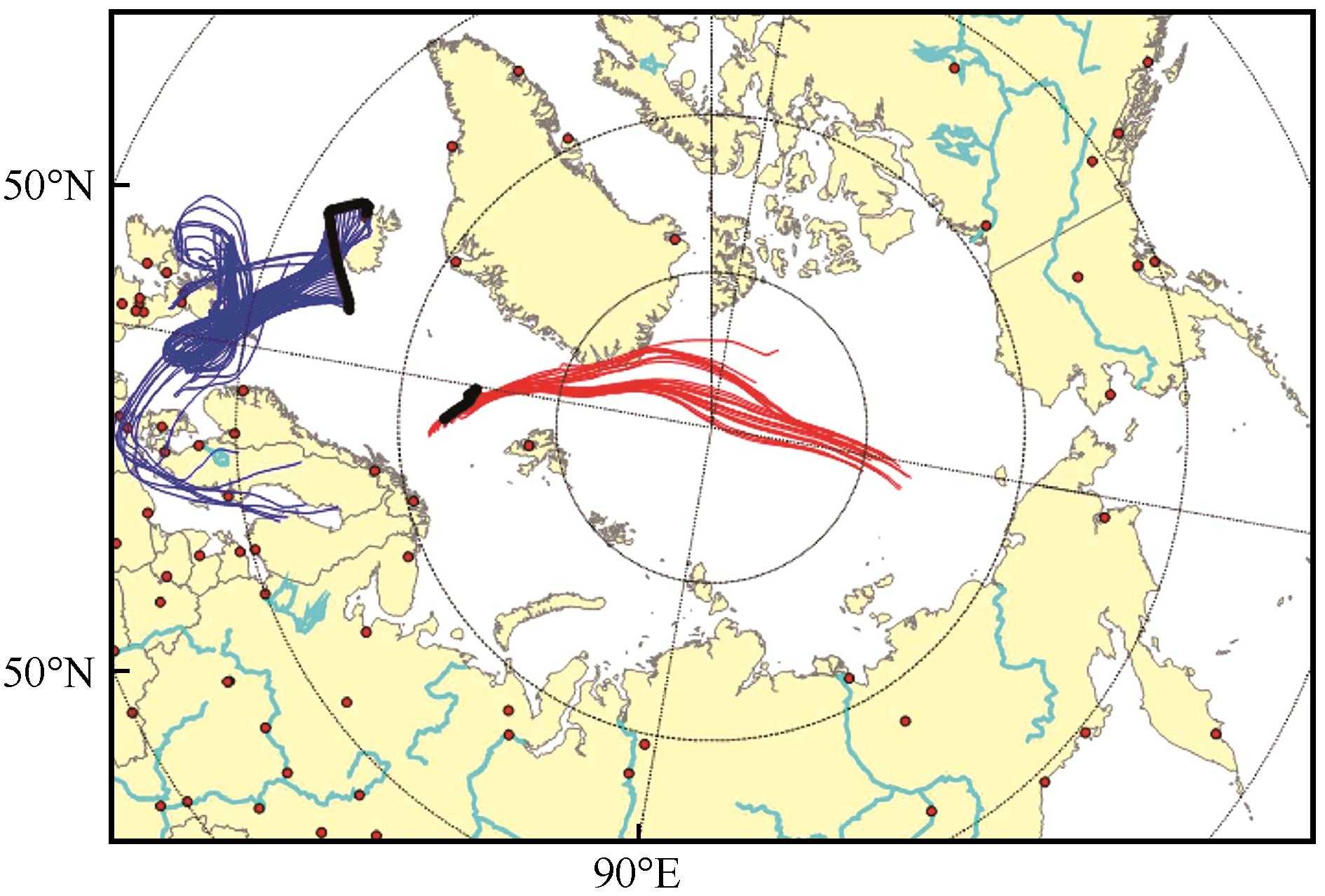
| 图5 特征样品采集期间的气团后向轨迹。图中红色实线为样品2采集期间[最低Δ17O(NO |
| Fig. 5 The backward trajectory analysis of air mass during the collection of featured aerosol samples. The red lines represent backward trajectories of air mass during the collection of Sample 2 in August 6—7 when Δ17O(NO |
|
|