1960—2020年高加索山地冰川变化研究
侯姗姗1,2( ), 王宁练1,2,3(), 李志杰1,2
), 王宁练1,2,3(), 李志杰1,2
Glacier variations in the Caucasus Mountains from 1960 to 2020
Shanshan HOU1,2(), Ninglian WANG1,2,3(), Zhijie LI1,2
), Ninglian WANG1,2,3(), Zhijie LI1,2
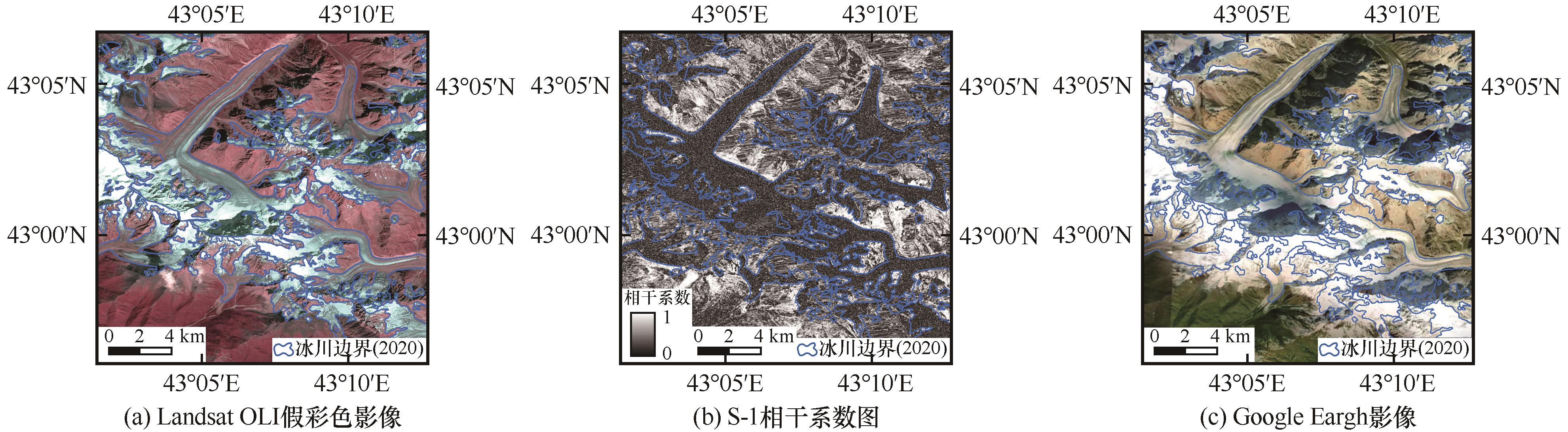
图4. 使用相干系数图像辅助解译表碛覆盖冰川示例
Fig. 4. Example of using coherence images to assist in the interpretation of debris-covered glacier: Landsat OLI image (bands 654 as RGB) (a); debris-covered glacier shown on S-1 coherence image (b); Google Earth (Maxar imagery, 0.30 m) (c)