1960—2020年高加索山地冰川变化研究
侯姗姗1,2( ), 王宁练1,2,3(), 李志杰1,2
), 王宁练1,2,3(), 李志杰1,2
Glacier variations in the Caucasus Mountains from 1960 to 2020
Shanshan HOU1,2(), Ninglian WANG1,2,3(), Zhijie LI1,2
), Ninglian WANG1,2,3(), Zhijie LI1,2
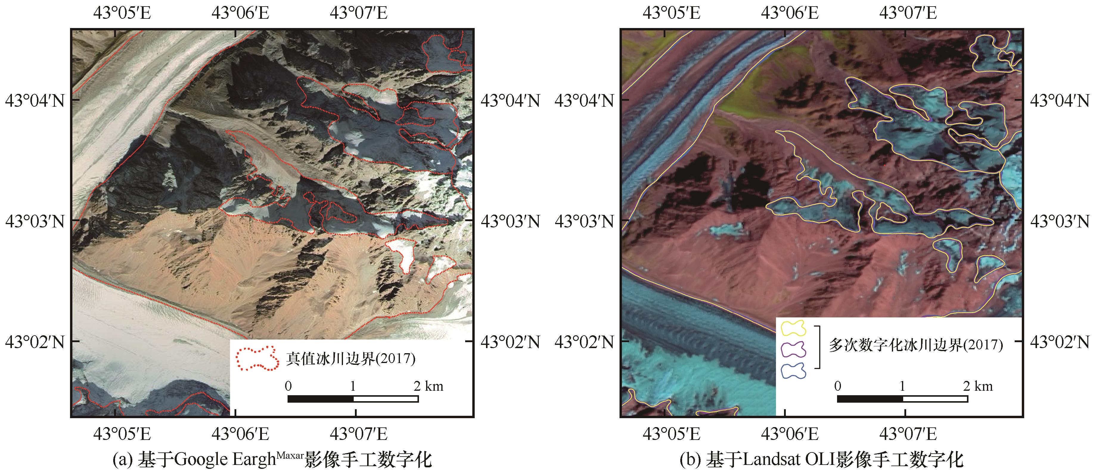
图5. 基于高分辨率遥感影像的冰川面积不确定性评估:基于Google EarthMaxar影像手工数字化的冰川边界(a);基于Landsat OLI假彩色影像多次手工数字化的冰川边界示例(b)
Fig. 5. Glacier area uncertainty assessment based on high-resolution imagery: manual digitization of glacier boundaries based on Google EarthMaxar imagery (a); example of glacier boundaries based on multiple manual digitization of Landsat OLI composite false colour imagery (b)