藏东南波堆藏布江谷地古冰碛堰塞湖初步研究
Preliminary study of the paleo-moraine dammed lake in the Bodui Zangbo River Valley, southeastern Tibet
藏东南波堆藏布江谷地古冰碛堰塞湖初步研究 |
| 谢金明, 周尚哲, 许刘兵, 杨太保, 何婷 |
|
Preliminary study of the paleo-moraine dammed lake in the Bodui Zangbo River Valley, southeastern Tibet |
| Jinming XIE, Shangzhe ZHOU, Liubing XU, Taibao YANG, Ting HE |
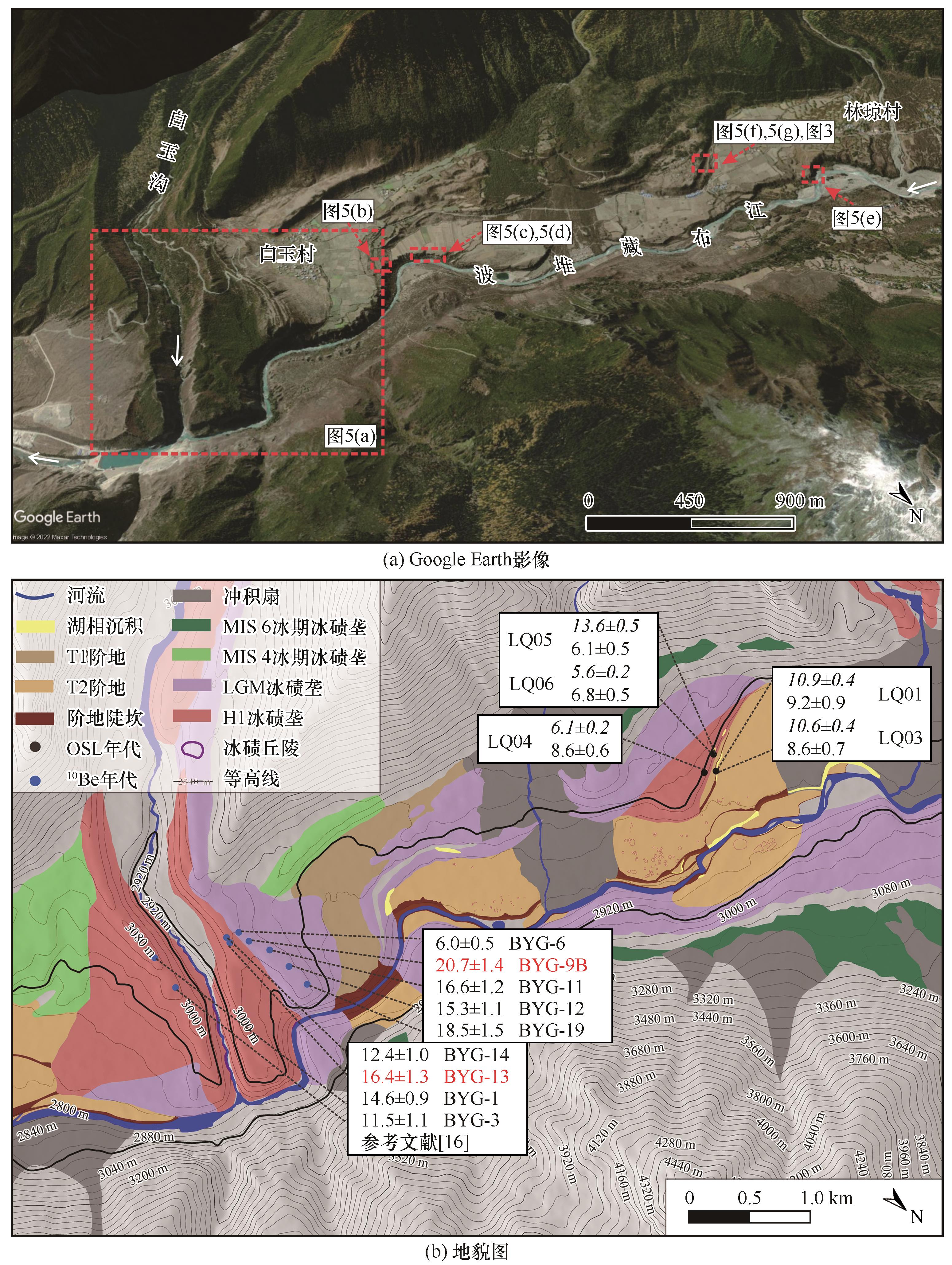
| 图2 波堆藏布江白玉村至林琼段地貌图 |
| Fig. 2 Geomorphologic map of the Baiyu-Linqiong reach of the middle Bodui Zangbo River: the Google Earth image of the Baiyu-Linqiong reach of the middle Bodui Zangbo River (a); geomorphologic map of the Baiyu-Linqiong reach of the middle Bodui Zangbo River(b) |
|
|