无人机搭载高分辨率传感器在精细地形监测中的应用
Application of UAV equipped with high resolution sensors in fine topographic mapping
无人机搭载高分辨率传感器在精细地形监测中的应用 |
| 程平平, 吴坤鹏, 肖乐天, 雷东钰 |
|
Application of UAV equipped with high resolution sensors in fine topographic mapping |
| Pingping CHENG, Kunpeng WU, Letian XIAO, Dongyu LEI |
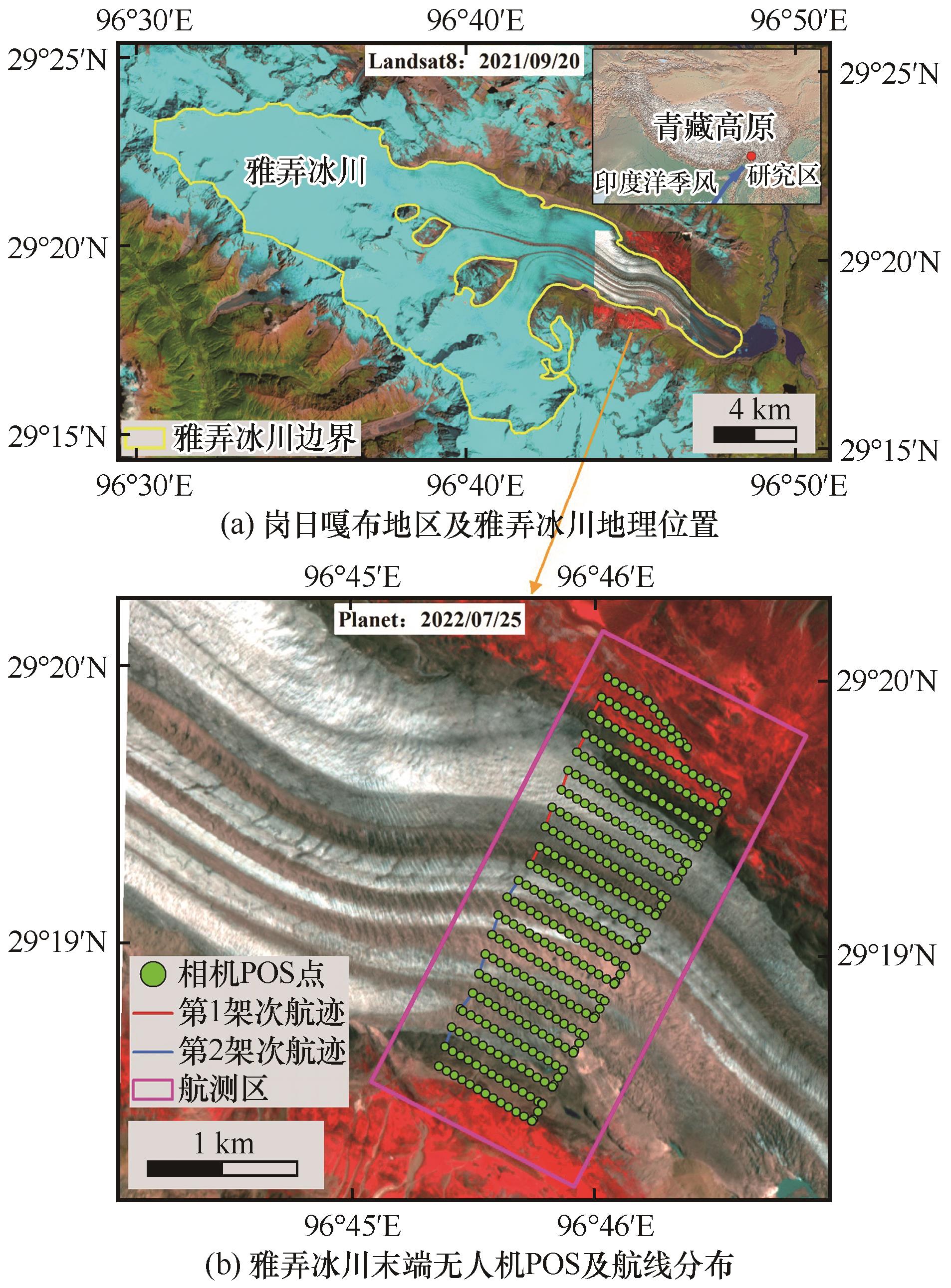
| 图1 岗日嘎布地区及雅弄冰川地理位置,底图为Landsat8影像(波段组合B654)(a);雅弄冰川末端无人机POS及航线分布,底图为Planet影像(波段组合B432)(b) |
| Fig. 1 Overview of the Kangri Karpo Mountains and Yanong Glacier, with background of Landsat OLI image (B654) (a); POS and Route of UAV at the terminal of the Yanong Glacier, with background of Planet image (B432) (b) |
|
|