无人机搭载高分辨率传感器在精细地形监测中的应用
Application of UAV equipped with high resolution sensors in fine topographic mapping
无人机搭载高分辨率传感器在精细地形监测中的应用 |
| 程平平, 吴坤鹏, 肖乐天, 雷东钰 |
|
Application of UAV equipped with high resolution sensors in fine topographic mapping |
| Pingping CHENG, Kunpeng WU, Letian XIAO, Dongyu LEI |
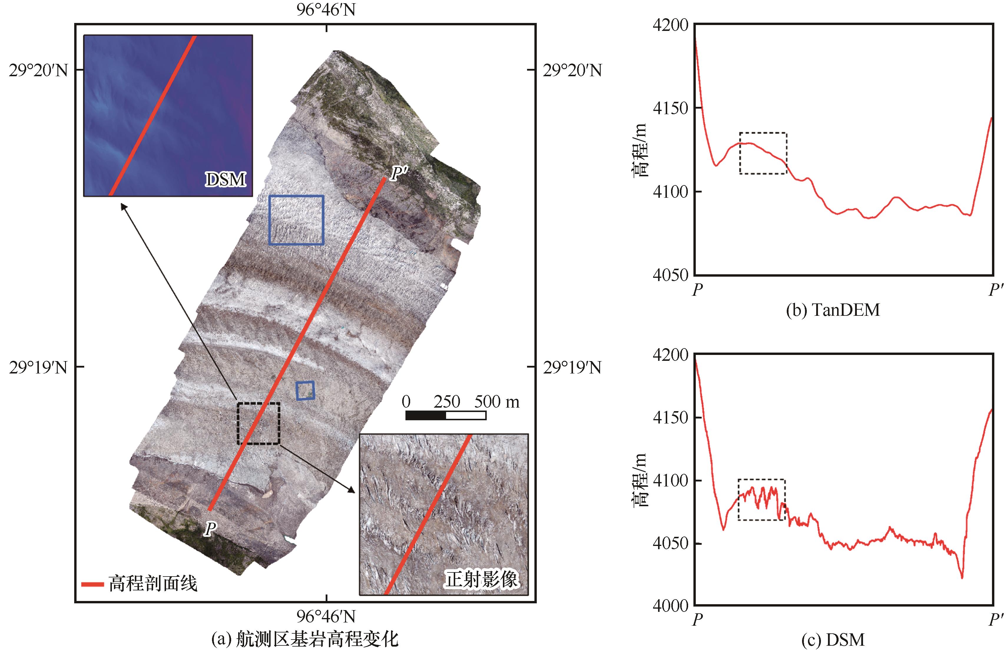
| 图5 航测区基岩高程变化(a)及冰面剖面高程起伏: TanDEM(b)、DSM(c) |
| Fig. 5 Elevation changes in bedrock (a) and elevation fluctuation in glacier surface along profile P-P′ with TanDEM (b) and DSM (c) |
|
|