祁连山讨赖河流域上游积雪时空分布及其变化研究
Spatiotemporal distribution of snow cover and its variation in the upper reaches of the Taolai River basin, Qilian Mountains
祁连山讨赖河流域上游积雪时空分布及其变化研究 |
| 武磊, 李奋华, 李常斌, 吕佳南, 谢旭红, 周璇 |
|
Spatiotemporal distribution of snow cover and its variation in the upper reaches of the Taolai River basin, Qilian Mountains |
| Lei WU, Fenhua LI, Changbin LI, Jianan LÜ, Xuhong XIE, Xuan ZHOU |
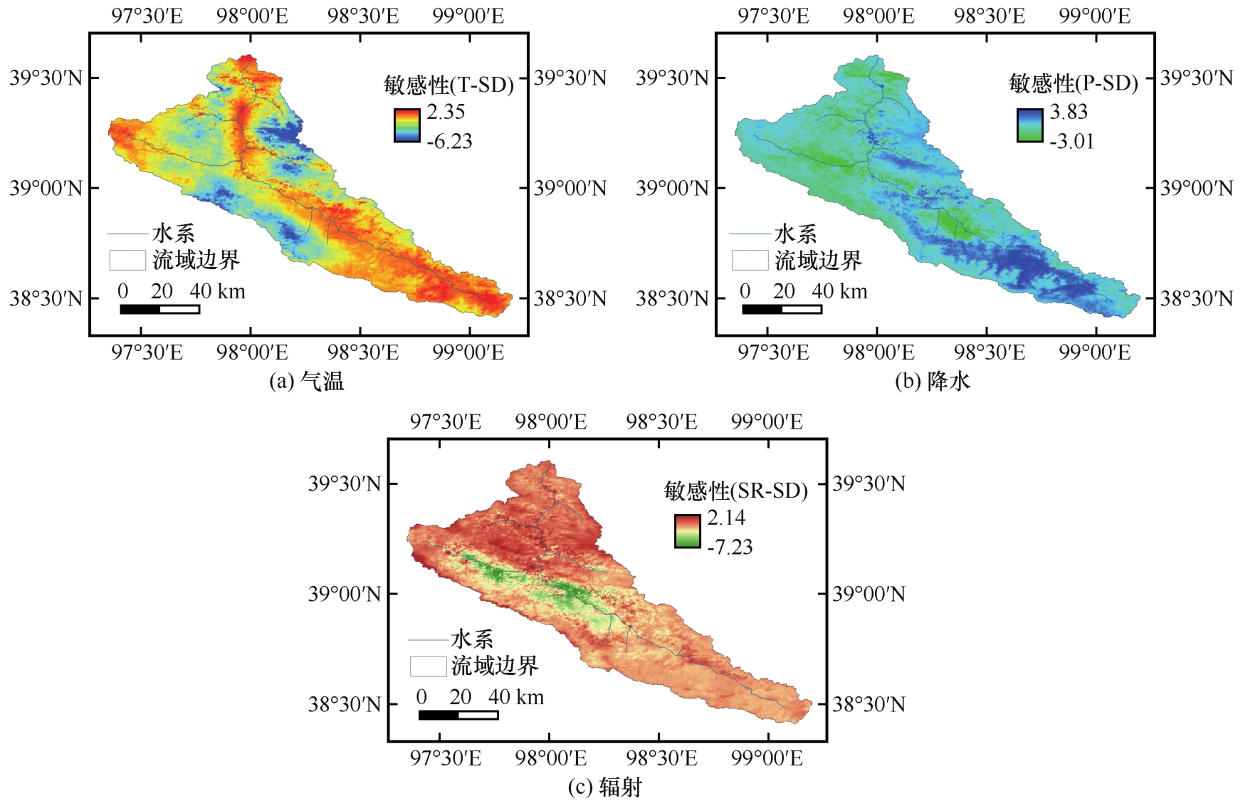
| 图8 讨赖河上游雪深对气温(a)、降水(b)和辐射(c)敏感性系数的空间分布(T、P、SR、SD分别表示气温、降水、辐射和雪深) |
| Fig. 8 Spatial distribution of sensitivity coefficients of snow depth to air temperature (a), precipitation (b) and radiation (c) in the upper reaches of Taolai River basin (T, P, SR and SD represent air temperature, precipitation, radiation and snow depth, respectively) |
|
|