Collections

Virtual Topic on "Study on Qilian Mountains"
The editor combed the papers in the field of Qilian Mountains published in the Journal of Glaciology and Geocryology since 2015, and selected 21 of them for readers. The thesis covers frozen soil, forest, hydrology, glaciers, ecological environment construction, snow, quaternary, climate, grassland, environmental microorganisms, land use, environmental hydrology, plant ecology, water resources management, soil, remote sensing, railway line engineering, etc. Discipline, hope to show the status quo of Qilian Mountain research.
Sort by Default Latest Most read  
Please wait a minute...
  • Select all
    |
  • HE Siwei, NAN Zhuotong, ZHANG Ling, YU Wenjun
    JOURNAL OF GLACIOLOGY AND GEOCRYOLOGY. 2015, 37(1): 211-225. https://doi.org/10.7522/j.issn.1000-0240.2015.0024

    Due to the influences of complex mountainous topography, the spatial-temporal characteristics of water and energy fluxes in a mountainous river basin are often dramatically changed. In this paper, a macro scale hydrologic model, the variable infiltration capacity (VIC) model, was used to simulate the spatial-temporal distribution of water and energy fluxes in the upper reaches of the Heihe River. The simulated results were validated with in-situ observations. It was showed that the VIC model is able to properly simulate the outlet discharge and net solar radiation, while it could only represent the changing trends of other variables, such as sensible heat flux, latent heat flux and ground heat flux. The simulated snow process differed from observations, leading to underestimation of outlet runoff, a sudden rise in soil moisture around April and a discrepancy in energy fluxes simulation. The VIC model has a good simulation of soil moisture in summer (from June to September), but bad in other months in which snow melting and soil thawing/freezing processes occur. Snow melting while top soil thawing will jointly induce a sudden rise in soil moisture, and top soil freezing will induce a fast drop in soil moisture. Overall, the VIC model is capable of simulating the spatial-temporal distribution of water and energy fluxes in mountainous basins with spaces to be improved where snow melt and soil thawing/freezing take place.

  • FANG Xiaoyu, LI Zhongqin, Bernd Wuennemann, GAO Shu, CHEN Rensheng
    JOURNAL OF GLACIOLOGY AND GEOCRYOLOGY. 2015, 37(2): 336-350. https://doi.org/10.7522/j.issn.1000-0240.2015.0037

    Glacier mass balance is regarded as the bridge and tie between the meteorology and water resources in glaciated regions, so monitoring and simulating mass balance is always one of the frontier research topics. A physical energy-balance model and four statistical degree-day factor models based upon temperature-index, radiation-index and temperature-radiation-vapor-index are presented, in which the Shiyi Glacier is taken as a case of study. The results are deeply analyzed and evaluated. When the degree-day factor model is enhanced by net shortwave radiation index, resulting in 90% of the ablation rate, the model will be improved significantly. The enhanced day-degree factor model combining with shortwave radiation and water vapor becomes the best model amongst all models. The results of energy/mass balance models suggest that net radiation is the dominant energy source to the glacier surface, accounting for 82.3% of all the inward fluxes, followed by the sensible heat flux, accounting for 17.7%of all the inward fluxes. The long wave radiation is mostly negative one during the modeling period. The ablation energy and latent heat flux account for 84.7% and 15.3% of the heat loss. The relative error of the radiation-vapor day-degree model is 7%, which is slightly higher than that in energy-balance model, 6.7%. Comparison suggests that the energy-balance model is more capable of modeling the value and the amplitude of variation, especially in daily scale. Likewise the statistical models perform insufficiently, especially, to the local specific topography. However, the statistical models require few input data, with computational simplicity. This study will be useful for establishing glacier mass-balance model in the Heihe River Basin and the Qilian Mountains.

  • PAN Haizhu, WANG Jian, LI Hongyi
    JOURNAL OF GLACIOLOGY AND GEOCRYOLOGY. 2015, 37(1): 49-57. https://doi.org/10.7522/j.issn.1000-0240.2015.0005

    Snow surface albedo plays an important role in the radiation budget and global climate models. In this paper, the observed albedo data are used to calculate the surface albedo as the true value to validate the albedo derived from TM/ETM+ image at 30 m, then the TM/ETM+ albedo is aggregated to 500 m resolution and compared with the MOD10A1 snow albedo daily (SAD). The results show that MODIS SAD products do not reflect snow albedo very well over mountains. However, the overall absolute error, standard deviation for the MODIS SAD products is 0.0548 and 0.0727, respectively, so it still can be used to study the snow cover change. A method for estimating snow albedo under cloud is developed. By using the MOD10A1 SAD and AMSR-E snow water equivalent (SWE) products, the snow under cloud is recognized, then use the SWE and Nash LSM snow albedo model to estimate the snow albedo under cloud. We can use this method to produce MODIS daily cloudless snow albedo product. The observed albedo data are used to validate the accuracy of the new SAD product. There is a relatively consistency between the MODIS SAD products after cloud removal and the observed ones, with an overall absolute error of 0.078.

  • WANG Bo, CHEN Tuo, XU Guobao, LIU Xiaohong, WANG Wenzhi, WU Guoju
    JOURNAL OF GLACIOLOGY AND GEOCRYOLOGY. 2015, 37(2): 318-326. https://doi.org/10.7522/j.issn.1000-0240.2015.0035

    Three tree-ring width chronologies were established by using the samples of Sabina przewalskii from the timberlines in the Middle Qilian Mountains. Correlation analysis and response analysis showed a significant negative correlation between tree-ring width and snow depth or snow cover area. After identifying the relationship between snow depth and tree growth, the maximum snow depth in September in the previous year is able to be reconstructed using tree-ring width data. The reconstruction reflects the snow depth variation well. And there have been three high snow depth periods in the study area in the last 270 years: 1740-1780, 1825-1880 and 1910-1980. Moreover, in the long term, variation of snow depth keeps pace with glacier variation in the Qilian Mountains and other parts of western China. In addition, snow depth has an obvious negative relationship with temperature.

  • WANG Shengting, SHENG Yu, WU Jichun, LI Jing, CHEN Ji
    JOURNAL OF GLACIOLOGY AND GEOCRYOLOGY. 2015, 37(1): 27-37. https://doi.org/10.7522/j.issn.1000-0240.2015.0003

    The source regions of the Datong River are located in the mid-east part of the Qilian Mountains with alpine permafrost. The characteristics and changing tendency of the permafrost were analyzed by using data from boreholes and surface observation. Regression analysis indicates that the mean annual ground temperature of permafrost in the source regions decreases with altitude with a gradient of about 3.82 ℃·km-1. The mean annual ground temperature within the permafrost is affected by surface condition closely. The permafrost depth in the source regions is also significantly dependent on altitude. With the rising of elevation by 100 m, the thickness of permafrost increases about 10 m. In the plain areas, the depth of permafrost is ranging from 17 to 86 m.Active layer thickness is closely related to local factors, especially land cover condition.There is no clearly zonality relationship between active layer thickness and altitude. Under the impact of rising temperature and human activities, permafrost in the source regions is overall in the state of degradation, and the mean annual ground temperature is increasing at a rate of about 0.0075 ℃·a-1.

  • WEI Xiao, CHANG Xuexiang, YANG Qiyue, LIU Bing, WANG Guohua
    JOURNAL OF GLACIOLOGY AND GEOCRYOLOGY. 2015, 37(1): 87-94. https://doi.org/10.7522/j.issn.1000-0240.2015.0009

    Nocturnal sap flow has ecological and physiological significant for plants, and it is part of plant water that cannot be ignored. The variations of Picea crassifolia nocturnal sap flows in different weather conditions and their responses to meteorological factors and tree size in the Qilian Mountains are analyzed, in order to have a better understanding of the transpiration of Picea crassifolia. During June 12 to October 16, 2011, sap flow velocities of seven Picea crassifolia trees were measured continuously by SF-300 heat pulse meters. Microclimate data were collected synchronously by two automatic weather stations in Pailugou watershed. The nocturnal sap flow velocity was measured from (2.78±0.64) g·cm-2·h-1 to (5.02±1.06) g·cm-2·h-1 in typical sunny days and from (2.31±0.62) to (3.94±1.22) g·cm-2·h-1 in typical cloudy days, with the average values of (3.55±0.28) g·cm-2·h-1 and (3.06±0.24) g·cm-2·h-1, respectively. Nocturnal sap flow is (34.51±6.20) % of the total daily flow in typical sunny days and (46.06±11.20) % of that in typical cloudy days. Nocturnal sap velocity is significantly correlated with vapor pressure deficit and temperature, and insignificantly correlated with wind speed. Nocturnal sap flow has linear relationships with diameter at the breast height, tree height, sapwood area, product of tree height and the square of diameter at the breast height, respectively. But nocturnal sap flow is insignificantly related with crown size. In conclusion, the variation of nocturnal sap flow of Picea crassifolia is controlled by its physiological characteristics and the environmental factors. Nocturnal sap flow of Picea crassifolia is used for transpiration and water recharge.

  • WU Jiazhang, YI Chaolu, XU Xiangke, QIAO Baojin, LIU Yushuo
    JOURNAL OF GLACIOLOGY AND GEOCRYOLOGY. 2015, 37(3): 595-603. https://doi.org/10.7522/j.issn.1000-0240.2015.0067
    By using the Laohugou Glacier No.12 digital elevation model derived from measurement, a series of transverse profiles on the Laohugou Glacier No.12 surface were fitted with quadratic equations, then combined with differential GPS measuring moraine ridge forms, the ice volume variations since the Holocene of the Glaciers No.14 and No.16, which lay on the headwaters of the Bailanghe River, were estimated. The results show that the ice volume have decreased 0.38 km3 since the Neoglaciation, Glaciers No.14 and No.16 have decreased 0.016 km3and 0.047 km3, respectively, during the Little Ice Age. According to the time of the maximum glaciation in different periods of the Holocene in the Qilian Mountains, the velocity of the ice volume shrinkage of Glaciers No.14 and No.16 since the Holocene are estimated to be 12.2×10⁻⁵~15.0×10⁻⁵ km3·a-1 since the Neoglaciation, and 4.0×10⁻⁵~5.3×10⁻⁵ km3·a-1 and 11.75×10⁻⁵~15.7×10⁻⁵ km3·a-1, respectively, since the Little Ice Age.
  • NIU Yun, LIU Xiande, MIAO Yuxin, CHE Zongxi
    JOURNAL OF GLACIOLOGY AND GEOCRYOLOGY. 2015, 37(5): 1353-1360. https://doi.org/10.7522/j.isnn.1000-0240.2015.0149

    Soil water and temperature impact greatly the function of water conservation. In order to study space change of water conservation function in a basin, the Dayekou basin in the Qilian Mountains has been chosen to study the spatial variation characteristics of soil temperature, and one million data has been obtained by 90 detectors of soil moisture and temperature, which has been analyzed by using the methods of variation coefficient. Results showed that:(1) There is a variation trend that soil moisture increases with altitude by a rate of about 2.35%·(100m)-1, and soil temperature decreases with altitude by a rate of about 0.74℃·(100m)-1.(2) The soil moisture on half-shady slopes is 1.2 times higher than that on half-sunny slopes, and 1.7 times higher than that on sunny slopes, and the soil moisture on half-sunny slopes is 1.4 times higher than that on sunny slopes. The soil temperature on half-shady slopes is 1.6 times lower than that on half-sunny slopes, and 2.2 times lower than that on sunny slopes, and the soil temperature on half-sunny slopes was 1.3 times lower than that on sunny slopes.(3) The correlation between soil moisture and depth is a quadratic parabola relation, with a linear temperature decreasing rate of about 0.536℃ per 10 cm.(4) The soil moisture under sub-alpine scrub forest is 1.5 times higher than that under arbor forest, 1.7 times higher than that under grass, and the soil moisture under arbor forest is 1.2 times higher than that under grass; The soil temperature under sub alpine is 1.6 times lower than that under arbor forest, and 2.3 times lower than under grassland. The soil temperature under arbor forest is 1.4 times lower than that under grassland.(5) The variation of soil temperature is the most severe on high altitude and half shady slopes, and the variation of soil temperature under grassland is the lowest on low altitude slopes and sunny or half-sunny slopes. This research conclusion is useful for searching river basin water balance and water conservation function, adjusting and managing stand structure and utilizing water resources.

  • WANG Yuzhe, REN Jiawen, QIN Xiang, LIU Yushuo, ZHANG Tong, CHEN Jizu, LI Yawei, QIN Dahe
    JOURNAL OF GLACIOLOGY AND GEOCRYOLOGY. 2016, 38(1): 28-35. https://doi.org/10.7522/j.isnn.1000-0240.2016.0004
    The bed elevation and ice depth of a mountain glacier are important boundary conditions for numerical ice flow modelling, which can be used to project future glacier evolution under a changing climate. In the ablation seasons of 2009 and 2014, ground-penetrating radar sound was carried out on the Laohugou Glacier No.12, Qilian Mountains. The glacier depth and bed topography along the centerlines and glacier cross-sections were obtained. The characteristics of ice depth change along the centerlines were studied and the shapes of cross-section profiles were quantitatively analyzed. The sound results show that the average ice depths along the centerlines of the eastern tributary (ET) and the western tributary (WT) were about 190 m and 150 m, respectively. The ET's bed topography was in general more rugged than that of WT, while surface slopes of both tributaries were gentle. When tributaries entered the confluence area, the ice depths of ET and WT were 122 m and 157 m, respectively. Due to transverse compression and convergence from the two tributaries, the ice depth increased to 162 m at the center of the confluence area. The form of glacial valley had spatial variation and were in general closer to V-shape. However, the valley of the confluence area had widened, and the glacial troughs developed more asymmetric.
  • MAO Shaojuan, WU Qihua, LI Hongqin, ZHANG Fawei, LI Yingnian
    JOURNAL OF GLACIOLOGY AND GEOCRYOLOGY. 2015, 37(5): 1372-1380. https://doi.org/10.7522/j.isnn.1000-0240.2015.0151
    Changes of community structure, aboveground biomass, species diversity and the relationship between biomass and species diversity in an alpine-cold forb meadow under different grazing intensities in the northeast Tibetan Plateau, China, were studied. Results show that:1) The vertical structure differentiation was not obvious in heavy grazing(HG) with only 1 layer structure, while, in light grazing(LG), moderate grazing(MG) and non-grazing(CK), the vertical structure changed to two layers because of the better growth of grasses and Kobresia humilis; 2) the important value(IV) of Sedge, Gramineae and Forbs varied differently under different grazing intensities; The community compositions maintained at a high level in CK and MG, while it decreased in HG; 3) despite that short-term overgrazing might inhibit the growth of desirable forage and decrease the communities composition, the communities composition remained stable, because the constructive and dominant species had strong adaptability owing to their grazing resistance, eco-biological and hereditary characteristics; 4) the order of aboveground biomass was Sedge >Gramineae >Forbs in CK, LG and HG, while the order was Gramineae >Sedge >Forbs in MG, and the order of total biomass was MG >LG >CK >HG; the order of root-shoot ratio was HG >CK >MG >LG and the difference between HG and LG was significant.
  • XIE Huanhuan, MA Wenying, ZHAO Chuanyan, GAO Yunfei, WANG Qingtao
    JOURNAL OF GLACIOLOGY AND GEOCRYOLOGY. 2016, 38(3): 653-661. https://doi.org/10.7522/j.issn.1000-0240.2016.0072
    Partitioning carbon flux is a very important step in understanding ecosystem- level carbon cycling. Studies of the processes and mechanisms of different components of carbon flux will help to promote greenhouse gases mitigation,carbon sequestration and storage and climate change adaptation. The objectives of this study were to analyze the hourly variations of the soil respiration,ecosystem rates and environmental factors,to determine the relative contributions of the autotrophic and the heterotrophic respiration to the soil respiration,to compare the day and night soil respiration rate,to evaluate the impact of soil temperature and moisture,underground and aboveground biomass on the soil respiration rate. The study area is located in the middle section of the Qilian Mountains. By investigation and monitoring with Li-8100 soil carbon flux system,the soil respiration and the ecosystem respiration were measured from June to August in 2013 and 2015. At the same time,soil temperature at 10 cm depth and moisture at the 5 cm depth below surface were measured. Relations of the respiration rate with soil temperature and moisture were determined by fitting both into an exponential model and a two-factor model. The results show that in the growing season,the subalpine grassland respiration rate had obvious daily changes in the form of a single-peaked curve for the four components(the ecosystem respiration(Re),the soil respiration(Rs),the autotrophic respiration(Ra)and the heterotrophic respiration(Rh)). The rank of the respiration rates was:Re(11.07μmol·m-2·s-1)> Rs(6.31μmol·m-2·s-1)> Rh(4.92μmol·m-2·s-1)> Ra(1.39μmol·m-2 ·s-1). The contribution rate of the autotrophic respiration and the heterotrophic respiration to soil respiration estimated in the growing season were 22.03% and 77.97%,respectively. The daily respiration(71% of the total) was more than the night respiration(29% of the total). The ecosystem respiration,soil respiration and heterotrophic respiration were exponentially related to the temperature of soil at 10 cm depth. The Q10 values of the ecosystem respiration,the soil respiration,and the heterotrophic respiration were calculated based on the soil temperature, which were 2.49,2.76,and 3.74,respectively. The respiration rates of the three components had a significantly negative linear relationship with the soil moisture. Considering soil temperature and soil moisture,the relationship between the respiration rate and the two factors was better fitted using a two-factor model,which was able to explain 89%,79% and 62% variation in the heterotrophic respiration,the soil respiration and the ecosystem respiration,respectively. There were a significant positive linear correlation between aboveground biomass and soil respiration and a quadratic regression correlation between soil respiration and underground biomass(P=0.01). From the viewpoint of cutting grass treatment,the rank of soil respiration rates was:never cutting year> one cutting year> two cutting years.
  • MA Suhui, MU Cuicui, GUO Hong, ZHANG Xiankai, LI Zeyuan, ZHANG Tingjun
    JOURNAL OF GLACIOLOGY AND GEOCRYOLOGY. 2018, 40(3): 426-433. https://doi.org/10.7522/j.issn.1000-0240.2018.0048
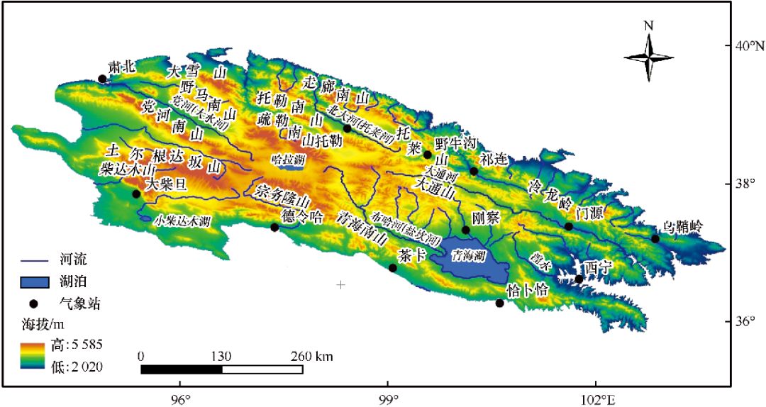
    The heterogeneity of mountain permafrost affects the alpine vegetation type and have an effect on the distribution of soil organic carbon (SOC). In this study, the SOC densities and soil physical and chemical properties were measured on soil samples, which sampled from eight active layers within three types of vegetation cover (swamp meadow, alpine swamp meadow and alpine steppe). It was found that the average SOC density was highest in alpine swamp meadow (49.50 kg·m-2), following by alpine meadow (11.22 kg·m-2), and in alpine steppe it was the lowest (7.30 kg·m-2). In a vertical profile of SOC density, there was a slightly difference:no obvious variation in alpine swamp meadow, decreasing with depth in alpine meadow and alpine steppe, with a significant aggregation in surface. There were positive relationships between SOC density and soil moisture, silt and clay content, and a negative relationship between SOC density and pH value. General linear model result shows that the soil moisture content, pH value and soil particle composition are able to explain 96.39% of the organic carbon density variation, of which 81.53%, 9.33% and 4.75% are attributed to soil moisture, pH value and soil texture, respectively. It means that soil moisture plays a key role in distribution of SOC density in alpine permafrost regions.
  • WANG Tao, GAO Feng, WANG Bao, WANG Penglong, WANG Qinhua, SONG Hualong, YIN Changliang
    JOURNAL OF GLACIOLOGY AND GEOCRYOLOGY. 2017, 39(2): 229-234. https://doi.org/10.7522/j.issn.1000-0240.2017.0026
    The ecological protection and management of Qilian Mountains has always been the focus of national, local government and local residents. How to ensure water security and ecological stability in the region are the top priority of current work. This paper points out the existing problems and challenges in the ecological environment protection and restoration of the Qilian Mountains. In view of these problems, this paper puts forward the following suggestions: strengthen the management system mechanism, establish the comprehensive ecological monitoring system, carry out the Ecological Red Line delineation study, speed up the improvement of ecological compensation mechanism, and strengthen the application of ecological restoration technology demonstration recommendations, so that promotes the progess of Gansu Province in ecological protection and management of Qilian Mountains.
  • YANG Ruiqi, XUE Lingui, CHANG Sijing, ZHANG Gaosen, CHENG Tuo, LIU Guangxiu, ZHANG Yong, GAO Haining
    JOURNAL OF GLACIOLOGY AND GEOCRYOLOGY. 2016, 38(3): 785-793. https://doi.org/10.7522/j.issn.1000-0240.2016.0088
    In this study,the distribution characteristics of low-temperature crude oil degrading bacterial population in soil from Yeniugou in the south side of the Qilian Mountains was investigated. The results showed that the quantities of degrading bacterium in this region were between 0.3×10⁵~1.4×10⁵CFU·g-1,which also decreased with altitude. Meanwhile,through 16S rRNA gene sequence analysis,it was detected that there were four phylum,seven genera and 25 species;among them,Pseudomonas and Arthrobacter were predominant genera. It was also found that the strains isolated from the altitude of 3579m had relatively higher utilization potential and the strains belonging to the genus Acinetobacter had the highest utilization potential for crude-oil.
  • WANG Haijun, KONG Xiangdong, ZHANG Bo
    JOURNAL OF GLACIOLOGY AND GEOCRYOLOGY. 2016, 38(5): 1440-1446. https://doi.org/10.7522/j.issn.1000-0240.2016.0169

    Logic regression model and spatial analysis technology were used to evaluate the suitability of land use in the Heihe mountain areas. An index system of evaluation was established, which included temperature, precipitation, digital elevation model, slope, population, water system, communication network and distribution of towns based on the land use data in 2011. The multi-scale training method was used to determine the best evaluation scale. Then, the contributions of all the evaluation factors were calculated based on the logic regression analysis. Spatial Analyst Module was used to evaluate the suitability of land use. The results show that:(1) the best scale of evaluation is 210 m (ROC=0.79); (2) slope and temperature (βTemp=1.11) play a very important role in the change of forest and grassland. In addition, the distance to roads and the density of population have a significant impact, with a β of -0.555; (3) the suitability ranks as forest land=cultivated land > settlements > nudation > grassland > water areas, with the value of suitability is 0.99 for forestland and cultivated land.

  • FENG Yawei, SUN Ziyong, BU Jianwei, CAI Hesheng
    JOURNAL OF GLACIOLOGY AND GEOCRYOLOGY. 2017, 39(3): 680-687. https://doi.org/10.7522/j.issn.1000-0240.2017.0077
    Research of the hydrogeochemistry in the source regions of the Heihe River is useful to search the basic changes in water quality along the river, and has positive significance for protecting the eco-environment in the regions. Through the previous researches, the lack of relevant background information about water quality in the source regions has improved. In this study, the source regions of the Heihe River are taken as the research object to understand the water quality of the river basin, through sampling and tasting the river water. The results show that the major chemical composition of the river water are K+, Na+, Ca2+, Mg2+ and Cl-, NO3-, HCO3-, SO42-. According to cluster analysis, Schukalev classification and trilinear diagram analysis, it was found that among the major ions, cations mainly comes from limestone weathering products, SO42- mainly comes from evaporating of mineral weathering products and human activities, and HCO3- mainly comes from pure carbonate weathering substances. Through heavy metal pollution surveying, it was found that the content of V, Co, Cu, Pb, Cr, Mn and Zn are much higher, and mine exploration is the main cause of heavy metal pollution.
  • HAN Tao, WANG Dawei, LI Lili
    JOURNAL OF GLACIOLOGY AND GEOCRYOLOGY. 2018, 40(3): 511-527. https://doi.org/10.7522/j.issn.1000-0240.2018.0056
    Medium Resolution Spectral Imager (MERSI) on board China's new generation polar orbit meteorological satellite FY-3A provides a new data source for snow monitoring in large area. As a case study, the typical snow cover of Qilian Mountains in northwest China was selected in this paper to develop the algorithm to map snow cover using FY-3A/MERSI. By analyzing the spectral response characteristics of snow and other surface elements, as well as each channel image quality on FY-3A/MERSI, the widely used Normalized Difference Snow Index (NDSI) was defined to be computed from channel 2 and channel 7 for this satellite data. Basing on NDSI, a tree-structure prototype version of snow identification model was proposed, including five newly-built multi-spectral indexes to remove those pixels such as forest, cloud shadow, water, lake ice, sand (salty land), or cloud that are usually confused with snow step by step, especially, a snow/cloud discrimination index was proposed to eliminate cloud, apart from use of cloud mask product in advance. Furthermore, land cover land use (LULC) image has been adopted as auxiliary dataset to adjust the corresponding LULC NDSI threshold constraints for snow final determination and optimization. This model is composed as the core of FY-3A/MERSI snow cover mapping flowchart, to produce daily snow map at 250m spatial resolution, and statistics can be generated on the extent and persistence of snow cover in each pixel for time series maps. Preliminary validation activities of our snow identification model have been undertaken. Comparisons of the 104 FY-3A/MERSI snow cover maps in 2010-2011 snow season with snow depth records from 16 meteorological stations in Qilian Mountains region, the sunny snow cover had an absolute accuracy of 92.8%. Results of the comparison with the snow cover identified from 6 Terra/MODIS scenes showed that they had consistent pixels about 85%. When the two satellite resultant snow cover maps compared with the 6 supervise-classified and expert-verified snow cover maps derived from integrated MERSI and MODIS images, we found FY-3A/MERSI has higher accuracy and stability not only for nearly cloud-free scenes but also the cloud scenes, namely, FY-3A/MERSI data can objectively reflect finer spatial distribution of snow and its dynamic development process, and the snow identification model perform better in snow/cloud discrimination. However, the ability of the FY-3A/MERSI model to discriminate thin snow and thin cloud need to be refined. And the limitation, error sources of FY-3A/MERSI snow products would be assessed based on the accumulation of large amounts of data in the future.
  • SHAO Zhujie
    JOURNAL OF GLACIOLOGY AND GEOCRYOLOGY. 2018, 40(3): 588-597. https://doi.org/10.7522/j.issn.1000-0240.2018.0064
    The Lanzhou-Xinjiang Railway Second Double Line is the first and the longest high-speed railway in the high altitude and seasonal frozen areas in Northwest China. Based on the observation at three monitor sections, wide-spread frost heave had been captured over two freezing periods (2015-2017). The results showed that the heave mainly occurred in the coarse fills that have been ever considered as unsusceptible to frost heave. The frozen period was nearly five months and the maximum frozen depth ranged from 3.0 to 3.8 m, two times of original frozen depth. The maximum frost-heave amount can reach to 27.5 mm between the surface and a depth of 2.7 m. The water content in crushed rock layer (0~0.5 m) is less than 4% in warm reason, and decreases in cold reason. The water content in coarse soil layer (under 0.5 m depth) is relative higher, between 8% and 15%, and the water content in warm reason is lower than that in cold reason, distributing as a sine curve. With the depth increasing, the water content decreases gradually. The development process of frost heave can be divided into three linear phases, and the maximum growth rate of frost-heave amount occurs from the middle or last ten days of December to the middle ten days of January, which means that in about twenty days in all a stable frost-heave amount will be reached.
  • JIANG Youyan, DU Wentao, HUANG Jin, ZHAO Huizhen, WANG Chengfu
    JOURNAL OF GLACIOLOGY AND GEOCRYOLOGY. 2017, 39(5): 1130-1136. https://doi.org/10.7522/j.issn.1000-0240.2017.0401
    Variations of vegetation play an important influence on regional ecosystem stability and ecological environment. In this paper, the MOD13A3 data were used to investigate the vegetation coverage in the Qilian Mountains during 2000-2015. The digital elevation model (DEM) and land cover classification were also applied to divide the interval altitude and different lands use to further discuss spatiotemporal pattern and variations of vegetation coverage, and then to analyze the climatic response by using meteorological data. The results presented that the vegetation coverage pattern in the Qilian Mountains is more in the east and less in the west, consistent with the spatial distribution of precipitation. The bush wood and alpine sparse meadow had grown better from 2000 through 2008, after then, they had gone worse. Meanwhile, alpine sylvosteppe and alpine meadow had become better. The whole vegetation coverage in the Qilian Mountains is increasing, which might be caused by the climatic changing to warmer and wetting.
  • QU Wei, LI Zhentao, Eefje AARNOUDSE, TAN Yanmei, ZHAO Yifang
    JOURNAL OF GLACIOLOGY AND GEOCRYOLOGY. 2018, 40(1): 145-155. https://doi.org/10.7522/j.issn.1000-0240.2018.0501
    Over the past 20 years, the water resources management in the Hexi Corridor region has undergone various institutional reforms, promoting the conjunctive management of surface water and groundwater in different degrees. However, the differentiation of water management efficiency in the three inland river basins in the Hexi Corridor region has become more and more obvious due to the differences in institutional settings and restriction of authority and reform objectives. Compared with the Shiyang River basin, the regulatory regimes and management practices in the Heihe River basin and Shule River basin are very chaotic. The lack of effective conjunctive management of surface water and groundwater is the key issue. This paper summarized the experiences and lessons of agricultural irrigation water management by combing the establishment of three water resources management agencies and their authority and management modes, and compared both advantages and disadvantages of the conjunctive management measures of surface water and groundwater in practice. Further explorations of the practical significance and realization path of the conjunctive management of river basins have been made, and the universal management of water resources in the inland river basins is discussed, in order to guarantee the smooth implementation of the water-saving strategy in the inland river basins. The practical experiences of the past 10 years have shown that conjunctive management of groundwater and surface water is the most effective way to improve the utilization efficiency of water resources and promote the sustainable utilization of water resources in inland river basins, and is the unique way to realize the green development of regional ecological environment.
  • WANG Tingting, FENG Qi, LI Zongxing, LI Jianguo
    JOURNAL OF GLACIOLOGY AND GEOCRYOLOGY. 2018, 40(3): 598-606. https://doi.org/10.7522/j.issn.1000-0240.2018.0065
    The increasing extreme climate events at the global scale are causing a series of scientific and societal issues under the background of global warming. The variations of daily temperature and precipitation of Gulang River basin in eastern Qilian Mountains showed that increasing frequency and amplitude of growing season length (GSL), summer days (SU25) and consecutive warm days (CWD) as well as prominent warming indicated the good response to global warming. The quasi-3-year and quasi-8-year periodicities of precipitation in whole basin were identified by wavelet analysis. Extreme wet day precipitation (R95P) is becoming more contribution for annual precipitation, but the simple daily intensity index (SDⅡ) presented regional diversity. The consecutive dry days (CDD) revealed that humidification is going prominent. This work provided the science and technology support to water source and ecological services in Gulang River basin.